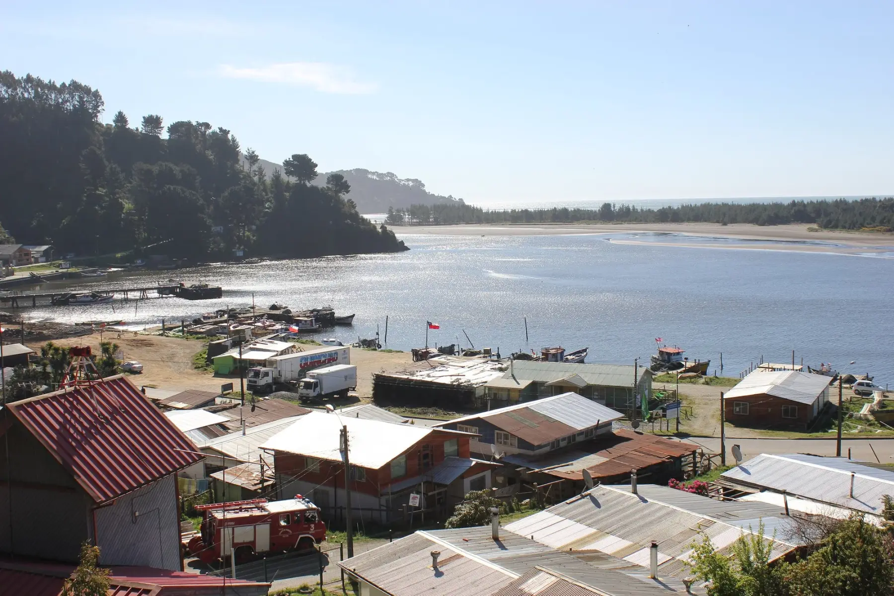
Toltén: where it is, things to do and how to get there
In short
Nueva Toltén, the seat of the Toltén district, lies on the south bank of the Toltén River, about 7 km from the Pacific and 100 km from Temuco (Wikipedia; Buses García). The town moved there after the earthquake and tsunami of May 22, 1960, which killed 30 residents of old Toltén (El Informador Digital, May 2026). In 2019 the maritime authority listed seven beaches in the district as unfit for swimming, including Caleta Queule and Agua de las Niñas (Directemar, via BioBioChile).
Toltén is the southernmost district on La Araucanía's coast: it covers 860 km² and had 9,722 residents in the 2017 census, and its seat, Nueva Toltén, sits on the south bank of the Toltén River, about 7 km from the Pacific Ocean (source: Wikipedia, "Toltén"). This guide covers what to do between Nueva Toltén, the river mouth and Caleta Queule.
Where is Toltén
- On La Araucanía's southern coast: Toltén is the southernmost district on the region's coast. Its seat, Nueva Toltén, sits on the south bank of the Toltén River, about 7 km from the Pacific Ocean (source: Wikipedia, "Toltén").
- From Temuco: about 97 km on Route 5 south to Freire, then Route S-60 through Teodoro Schmidt (source: OpenStreetMap, route calculated on October 15, 2026).
- Caleta Queule: about 30 km south of Nueva Toltén, via S-60 and S-790 (same source).
- Old Toltén: the old town lay about 8 km from Nueva Toltén and was moved after the 1960 tsunami (source: El Informador Digital, May 26, 2026).
Getting there from Temuco
- By car: take Route 5 south to Freire, then Route S-60 through Teodoro Schmidt to Nueva Toltén: about 97 km (source: OpenStreetMap, route calculated on October 15, 2026). From Nueva Toltén, Queule is about 30 km further south via S-60 and S-790 (same source).
- By bus: Buses García runs the Temuco–Nueva Toltén route (source: busesgarcia.cl). We found no official bus timetable to Queule, so ask in Nueva Toltén. More options in Getting around Araucanía without a car.
Old Toltén and the 1960 tsunami
- The old town: Toltén was founded in 1866 (source: Wikipedia, "Toltén"). On May 22, 1960, the earthquake and tsunami, with the sea surging inland and the Toltén River overflowing, killed 30 residents (source: El Informador Digital, May 26, 2026).
- The move: the government of the time bought the Collico estate and laid out Nueva Toltén there, about 8 km from the old town (same source); Wikipedia says 5 km.
- What remains: the Old Toltén cemetery, by the east bank of the river, is the only structure left from the old town (source: CIREN, "Atractivos turísticos comuna de Toltén", November 2022, with Sernatur data from 2012). Every May 22, residents commemorate the tragedy (source: El Informador Digital, May 26, 2026).
- Queule too: the village stood on the salt marsh, which the earthquake dropped by about two meters, and the tsunami swept it away (source: Diario UACh, May 25, 2010). More coast in the Araucanía Coast guide.
Things to do
- Caleta Queule: a fishing cove sheltered from the southerly winds, where you can eat fish and shellfish, especially mussels (source: CIREN, 2022). Boat trips and details on its page, Caleta Queule.
- Toltén River mouth: here you'll find Caleta La Barra, an artisanal fishing cove (same source).
- Wetlands: the Toltén wetlands, between the Boldo and Boroa rivers, are good for watching plants and wildlife such as wild ducks, swans and coypus, and Patagua lagoon lies on the site of old Toltén (same source). The Queule River wetlands were a pilot site of the Ministry of the Environment's GEF Coastal Wetlands project (source: Ministry of the Environment, 2020, cited by CIREN).
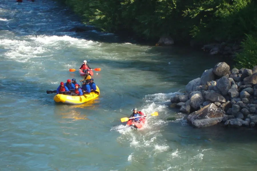
- Toltén Navegable route: it brings together 29 small businesses offering kayaking, birdwatching, recreational fishing and local food along the river (source: Temuco Televisión, October 31, 2024). Kayaking and guided fishing count as adventure tourism: check that the operator is listed in Sernatur's registry (serviciosturisticos.sernatur.cl), as Law 20,423 requires.
Beaches and sea safety
- The beaches: Playa Grande Los Pinos, 3 km of black sand; Agua de las Niñas, 250 m long, at the mouth of the Queule River; Nigue Sur, reached on a hand-pulled ferry; and Playa Ronca, on a gravel road (source: CIREN, 2022, with Sernatur data from 2012).
- Unfit for swimming: in 2019, Directemar, Chile's maritime authority, listed these Toltén beaches as unfit for swimming: Agua de las Niñas, Barra Toltén, Caleta Queule, Nigue Norte, Nigue Sur, Punta Ronca and Río Toltén (source: BioBioChile, December 26, 2019). The January 2025 list of approved beaches included none in Toltén (source: 24horas, January 10, 2025). Check with the maritime authority before going in the water.
- Maritime authority: the Toltén and Queule rivers fall under the Carahue Harbor Master (source: Official Gazette, Ministry of Defense Decree No. 391 of 2019, November 12, 2020). Maritime emergencies: 137 (source: Directemar, Chilean Navy).
- Tsunami: if you feel an earthquake that makes it hard to stay on your feet and you are in an evacuation zone, head immediately to high ground or a safe area (source: Senapred, tsunami leaflet, 2023). Check safe zones on Senapred's Chile Preparado map viewer (source: El Dínamo, July 30, 2025).
Season
- Summer festivals: the Queule Country Fair runs for three days in the second week of January; the Chanquín fair, 12 km from Nueva Toltén, in the first week of February; and the Gran Fritanga fish fry at Caleta La Barra, in the first half of February (source: CIREN, 2022). Dates change every year, so confirm them with Toltén Municipality. More fairs in Araucanía summer country fairs.
- Weather: La Araucanía's coast is mild and rainy, with cold wind even in summer (source: Sernatur, chile.travel, January 2026). Bring a waterproof jacket; ideas in summer.
Information reviewed on October 15, 2026. Buses, festivals and beach approvals change every season: confirm them with Toltén Municipality and the maritime authority before you travel.
Frequently asked questions
How do I get to Toltén from Temuco?
By car, take Route 5 south to Freire and Route S-60 through Teodoro Schmidt: about 97 km (OpenStreetMap). By bus, Buses García runs the Temuco–Nueva Toltén route (busesgarcia.cl).
What happened in Toltén in 1960?
The earthquake and tsunami of May 22, 1960 destroyed old Toltén and killed 30 residents; the town moved to the Collico estate, where Nueva Toltén was laid out (El Informador Digital, May 2026).
Can you swim at the beaches of Toltén and Queule?
In 2019 Directemar listed seven Toltén beaches as unfit for swimming, including Caleta Queule, Agua de las Niñas and Nigue Sur (BioBioChile, Dec 2019), and in January 2025 no Toltén beach was listed as approved (24horas). Check with the maritime authority.
What is there to do in Toltén?
Eat shellfish at Caleta Queule, visit the river mouth at Caleta La Barra, watch birds in the wetlands and see the Old Toltén cemetery (CIREN, 2022). In summer there are country fairs in January and February.
Sources: Wikipedia, «Toltén» (consultado el 15-oct-2026); Buses García, «Nueva Toltén» (busesgarcia.cl, consultado el 15-oct-2026); OpenStreetMap, ruta Temuco–Nueva Toltén–Queule calculada con OSRM (15-oct-2026); El Informador Digital, «Toltén Viejo conmemoró tragedia de 1960» (26-may-2026); CIREN (Ministerio de Agricultura), SIT Rural, «Atractivos turísticos comuna de Toltén» (nov-2022; cita a Sernatur, «Atractivos Turísticos Región de La Araucanía», 2012; Identidad y Futuro, 2020; Ministerio del Medio Ambiente, proyecto GEF Humedales Costeros, 2020, y Araucanía sin Fronteras); Diario UACh, «Científicos UACh buscan proteger marisma en Queule» (25-may-2010); Temuco Televisión, «Emprendedores de la Ruta Toltén Navegable ya están listos para recibir a turistas en esta nueva temporada 2024-2025» (31-oct-2024); BioBioChile, «Cerca de 800 playas no son aptas para el baño en el país: conoce cuáles son» (26-dic-2019, con datos de Directemar); 24horas, «Listado por región: las playas aptas para el baño en todo Chile» (10-ene-2025); Diario Oficial, decreto N° 391 de 2019 del Ministerio de Defensa Nacional, que modifica el DS N° 991 de 1987 sobre jurisdicción de las capitanías de puerto (CVE 1845169, 12-nov-2020); Senapred, díptico «Tsunami» (2023); El Dínamo, «Visor Chile Preparado: revisa cuáles son las zonas seguras de tu comuna y dónde evacuar ante alerta de tsunami» (30-jul-2025); Sernatur, chile.travel, costa de La Araucanía (enero de 2026, vía la «Guía de la Costa Araucanía»); Ley 20.423 (registro de prestadores de turismo aventura). Revisado el 15-oct-2026.