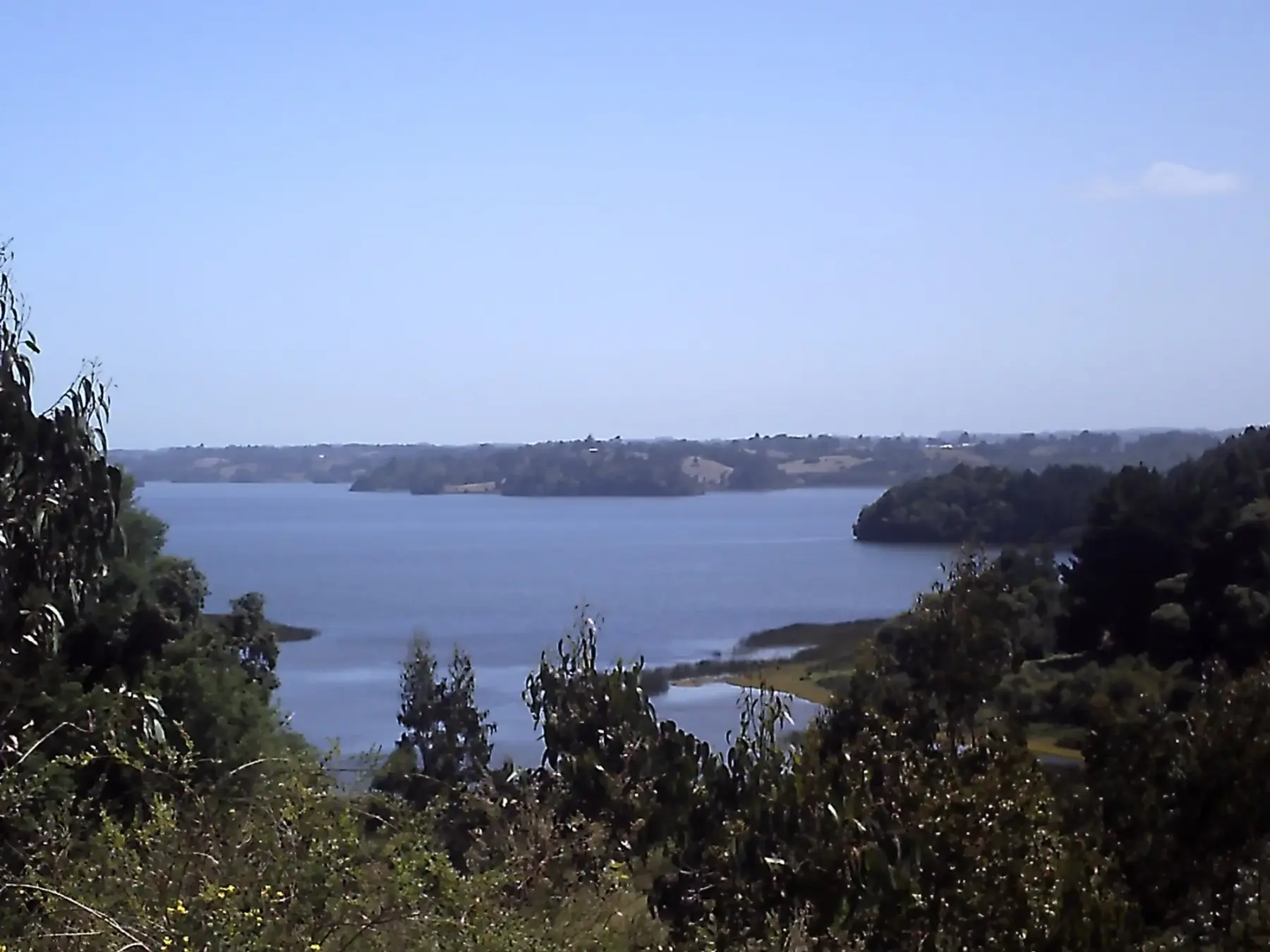
Araucanía Coast guide: Lake Budi and Puerto Saavedra
In short
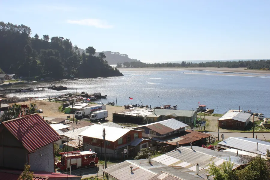
Lake Budi, about 85 km west of Temuco on route S-40, is a brackish lake of about 56 km² with Mapuche Lafkenche communities along its shores (Sernatur, January 2026). Puerto Saavedra, at the mouth of the Imperial river, was destroyed by the 1960 tsunami, with waves of 7 to 8 meters (SHOA, cited in Íconos journal, 2020).
On the Araucanía coast, the Imperial river meets the Pacific at Puerto Saavedra and, a little further south, lies Lake Budi, home to Mapuche Lafkenche communities (source: Sernatur, chile.travel, January 2026). This guide covers what to do in Puerto Saavedra and around the lake.
Getting there from Temuco
- By car: route S-40, officially named "Temuco - Nueva Imperial - Puerto Saavedra" (source: Vialidad, via OpenStreetMap), runs west through Nueva Imperial, about 35 km from Temuco, and Carahue, about 56 km away (source: Wikipedia). It is about 85 km of paved road to Puerto Saavedra, with views of the Imperial river (source: Sernatur, chile.travel, January 2026).
- From the airport: from La Araucanía Airport it takes about an hour and a half overland (same source).
- By bus: intercity buses run from Temuco to Puerto Saavedra several times a day, and there are buses to Carahue with connections to Puerto Saavedra (source: Saavedra Chamber of Commerce, Tourism and Services, destinosaavedra.cl).
- Lake roads: some rural stretches are gravel; Sernatur recommends a vehicle with good suspension (source: Sernatur).
Carahue, on the way
Carahue overlooks the Imperial river. Pedro de Valdivia founded La Imperial there in 1551, and the present town was founded on February 22, 1882 (source: Wikipedia, "Carahue").
Things to do in Puerto Saavedra
- History: founded on December 5, 1895 as Bajo Imperial, it took the name Saavedra in 1906 (source: destinosaavedra.cl).
- The 1960 tsunami: after the May 1960 earthquake, waves of 7 to 8 meters destroyed the town and the land sank between 1.2 and 2 meters (source: Inostroza-Matus, Molina-Camacho and Romero-Toledo, Íconos journal no. 66, FLACSO, 2020, with SHOA data). The river mouth moved (source: destinosaavedra.cl).
- Cerro Maule viewpoint, overlooking the river mouth: see its page, Puerto Saavedra and Cerro Maule.
- Casa del Telar, with Mapuche textiles (source: Sernatur, chile.travel).
Lake Budi
- It has about 56 km² of brackish water, and Sernatur describes it as the only brackish lake in South America (source: Sernatur, chile.travel, January 2026). The lake forms part of the boundary between the Saavedra and Teodoro Schmidt districts (source: Wikipedia, "Budi Lake").
- Birds: black-necked swans, gulls and cormorants; bring binoculars (source: Sernatur).
- More on its page: Lake Budi.
Puerto Domínguez and Huapi Island
Puerto Domínguez, known as "the garden of Budi", has the Lafken Leufu ruka. From there, the Carlos Schalchli ferry crosses to Huapi Island, a peninsula inhabited by Lafkenche communities (source: Sernatur, chile.travel). Check the ferry times locally.
Mapuche Lafkenche tourism
- On the lake's south shore, the Llaguepulli community has run its own rural and cultural tourism for almost 20 years, with codes of conduct set by the community (source: Álvarez et al., REDER journal, 2019).
- In Puerto Saavedra, Budi Lafken Mapu, run by Yesica Huenten Catrileo, won the best Indigenous tourism initiative award at WTM Latin America in 2024 (source: BioBioChile, April 17, 2024).
- Sernatur asks visitors to respect the traditions of the Mapuche Lafkenche communities (source: Sernatur, chile.travel). This is their territory: arrange visits with them and ask before photographing people.
Best time to go
Sernatur recommends it all year. The climate is mild and rainy, with a cold coastal wind even in summer; bring a rain jacket and cash, as ATMs are scarce (source: Sernatur, chile.travel, January 2026). Summer ideas in La Araucanía in summer.
Information reviewed on October 15, 2026. Bus and ferry times, services and road conditions change: confirm them before you travel.
Frequently asked questions
Where is Lake Budi?
On the Araucanía coast, about 85 km west of Temuco on route S-40, between the Saavedra and Teodoro Schmidt districts (Sernatur, January 2026; Wikipedia).
What is there to do in Puerto Saavedra?
Climb to the Cerro Maule viewpoint, visit the Casa del Telar and explore Lake Budi, Puerto Domínguez and Huapi Island (Sernatur, January 2026).
Is Lake Budi a saltwater lake?
It is brackish: about 56 km², and Sernatur describes it as the only brackish lake in South America (Sernatur, January 2026).
What happened in Puerto Saavedra in 1960?
The tsunami after the May 1960 earthquake destroyed the town with waves of 7 to 8 meters, and the land sank between 1.2 and 2 meters (Íconos journal, FLACSO, 2020, with SHOA data).
How do I get to Huapi Island?
On the Carlos Schalchli ferry from Puerto Domínguez (Sernatur). Check the times locally.
Sources: Sernatur, chile.travel, itinerario «Inmersión cultural lafquenche» (Lago Budi, Puerto Saavedra y Puerto Domínguez; actualizado el 5-ene-2026); Cámara de Comercio, Turismo y Servicios de Saavedra, destinosaavedra.cl («Historia de Saavedra» y «Cómo llegar»); Inostroza-Matus, Molina-Camacho y Romero-Toledo, «Desde la amenaza natural al desastre: una construcción histórica del terremoto y tsunami de 1960 en Saavedra», Íconos n.º 66, FLACSO Ecuador, 2020 (cita a SHOA 2000); Álvarez, Azócar, Marihuan, Montero y Rosenbluth, «Turismo indígena como respuesta a la siniestralidad: Comunidad Mapuche-Lafkenche del lago Budi, Chile», REDER 3(1), 2019; BioBioChile, 17-abr-2024; OpenStreetMap (ruta S-40, nombre oficial según Vialidad); Wikipedia, «Carahue», «Nueva Imperial» y «Budi Lake». Revisado el 15-oct-2026.