Nahuelbuta guide: how to get there and what to know
In short
Nahuelbuta National Park is reached from Angol along the road to Vegas Blancas, about 35 km mostly on gravel. As of October 15, 2026, CONAF's page shows it open Tuesday to Sunday, without the September 23 closure notice; Contulmo Natural Monument remains closed.
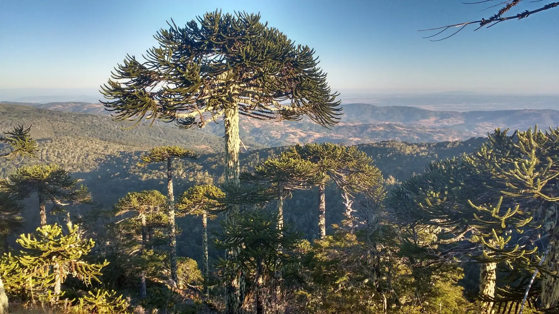
Nahuelbuta National Park protects the summits of Chile's Coastal Range and its araucaria forests. This guide explains how to get there from Angol and what to know before you go.
Status as of October 15, 2026
- Nahuelbuta National Park: open according to CONAF. Its official page, updated on October 14, 2026, shows it open Tuesday to Sunday and no longer carries the closure notice (source: CONAF, checked October 15, 2026).
- Note: in early October CONAF listed it as closed since September 23, 2026 due to weather and safety conditions (source: CONAF, checked October 5, 2026). Since the status changed within a few weeks, confirm with CONAF before you set off.
- Contulmo Natural Monument: closed since September 23, 2026 (source: CONAF, October 15, 2026).
Angol, the gateway
Angol is the access town for the park. From Temuco it is about 3 hours by car via Route 5 and R-86; if you fly into La Araucanía Airport, you can rent a car or take a bus to Angol and arrange the last stretch yourself or with a tour (source: Sernatur, chile.travel, January 2026). Angol is home to the Dillman S. Bullock Museum, with archaeological and natural history collections (source: Wikipedia).
How to get to Nahuelbuta National Park from Angol
- Main access: the road from Angol to Vegas Blancas (source: CONAF).
- Distance: about 35 km (source: GoChile). Andes Handbook gives 34 km via R-150P, which becomes R-126 (page published in 2015).
- Road: mostly gravel and demanding; a 4×4 or high-clearance vehicle is recommended, especially outside summer (source: Sernatur, chile.travel, January 2026).
- Winter: the access road can be cut off by snow (source: Andes Handbook).
- Roadworks: in February 2026 CONAF partially closed the park for works on route R-150 and its internal roads, including the one to Piedra del Águila (source: Las Noticias de Malleco, February 10, 2026).
- Other routes: from Angol via the road to Cotico, or from Cañete, in the Biobío Region, via Butamalal, El Chacay and Cayucupil (source: CONAF).
What to see
- The park: 6,831.9 hectares created in 1939 in the districts of Angol, Purén and Los Sauces, and Cañete in Biobío (source: CONAF).
- Coastal Range araucarias, alongside roble, coigüe and lenga trees (source: CONAF).
- Piedra del Águila: a viewpoint at 1,460 meters overlooking about 215 km, the full width of Chile; the trail is 6.4 km one way, about 2 hours, moderate (source: CONAF). From there you can see the Pacific and the Andean volcanoes (source: Sernatur, chile.travel).
- Other trails: Casa de Piedra (2.7 km, easy), El Aguilucho (1.6 km), Estero Los Gringos (3.6 km) and Cerro Anay (874 m) (source: CONAF).
- Wildlife: Darwin's fox, an endemic species (sources: CONAF; Sernatur, chile.travel).
Before you go
- There are no services inside the park (source: CONAF): bring water, food and warm clothes.
- Any heat source is banned, including camping stoves and cigarettes, and pets are not allowed (source: CONAF).
- Hours and tickets: check the park's page on conaf.cl.
Other places in Malleco
- Contulmo Natural Monument: although it shares its name with a Biobío town, CONAF places it in Los Sauces and Purén, Malleco province. It protects 82 hectares of fern-rich forest and has the 3.3 km Los Helechos trail (source: CONAF). It is currently closed.
- Purén and Lumaco valley: home to the kuel, Mapuche ceremonial mounds studied by archaeologists (source: Dillehay and Saavedra, Revista Austral de Ciencias Sociales, 2003). They remain part of community ceremonial life; we found no official visitor information, so do not enter community land without permission.
Information reviewed on October 15, 2026. Park status, roads and hours change: confirm with CONAF before you travel.
Frequently asked questions
Is Nahuelbuta National Park open?
As of October 15, 2026, CONAF's page shows it open Tuesday to Sunday and without the September 23 closure notice. Confirm before you go (CONAF, page updated October 14, 2026).
How do I get to Nahuelbuta National Park from Angol?
Along the road from Angol to Vegas Blancas, about 35 km, mostly gravel (CONAF; GoChile; Sernatur, chile.travel).
Do I need a 4x4 to reach Nahuelbuta?
A 4×4 or high-clearance vehicle is recommended, especially outside summer, because the road is gravel and demanding (Sernatur, chile.travel, January 2026).
How long is the Piedra del Águila trail?
It is 6.4 km one way and takes about 2 hours, with moderate difficulty (CONAF).
Are there services inside the park?
No. CONAF states there are no services inside: bring water, food and warm clothes (CONAF).
Sources: CONAF, «Parque Nacional Nahuelbuta» (conaf.cl, página actualizada el 14-oct-2026, consultada el 15-oct-2026; el cierre desde el 23-sep-2026 figuraba en la revisión del 5-oct-2026) y «Monumento Natural Contulmo» (consultada el 15-oct-2026); Sernatur, chile.travel, «Parque Nacional Nahuelbuta» (actualizado el 7-ene-2026); GoChile, «Parque Nacional Nahuelbuta»; Andes Handbook, «Piedra del Águila» (ficha publicada el 2-abr-2015); Las Noticias de Malleco, «Parque Nacional Nahuelbuta cierra temporalmente por obras de mejoramiento vial» (10-feb-2026); Wikipedia, «Museo Dillman S. Bullock»; Dillehay, T. y Saavedra, J., «Interacción humana y ambiente: el desarrollo de kuel en Purén-Lumaco», Revista Austral de Ciencias Sociales (2003). Revisado el 15-oct-2026.